
If you’re visiting Budapest and want to see more than just the city, it’s worth spending a day in the nearby hills.
Hungary doesn’t have very high or technically difficult mountains – all you need is a good pair of shoes, a map, and a light backpack with some snacks. To be fair, these are things you’d probably bring on a city walk as well.
Last weekend I went with my son to explore the viewpoints of Pilis-tető, just a short trip from the capital. It’s a perfect program to add to a long weekend in Budapest.
Pilis-tető
This hike takes you to the Pilis Hills, circling around the peak that gave the range its name: Pilis-tető. It’s a long, flat-topped mountain that rises sharply above the surrounding ridges.
The summit, where the Boldog Özséb Lookout Tower stands today, was opened to hikers only a few years ago. Before that, it was a military air-defense base. When the army left, the site was abandoned and decayed for decades. Now you can explore bunker ruins and garages where rocket carriers used to park. A modern lookout tower has also been built, offering wide views of Budapest and its surroundings.
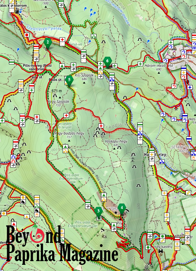
Starting point: Kétbükkfa-nyereg
Whether you arrive by bus or car, the hike starts at the Kétbükkfa-nyereg parking lot. Right away you’ll face a steep path. After a few meters on asphalt, follow the green cross trail marker up into the hills.
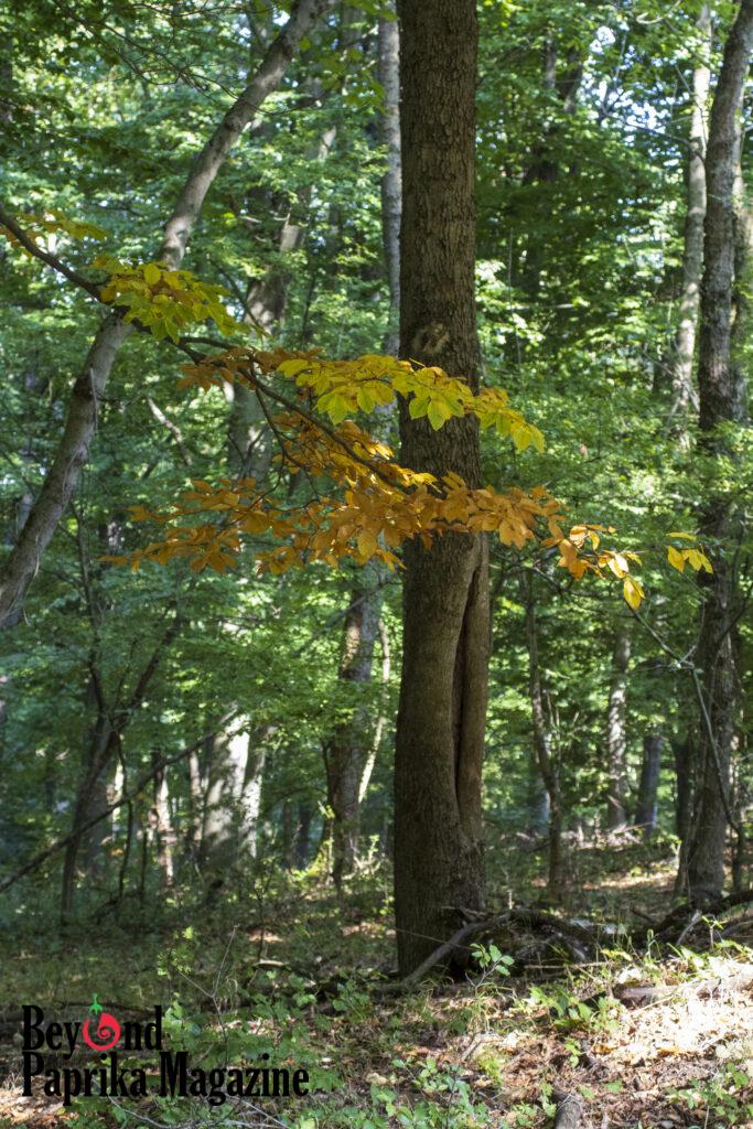
The path climbs through a peaceful beech forest. Soon you switch to the green triangle trail, which levels out for a while after the climb. Before long, you’ll reach the first viewpoint marked as #2 on the map: Fekete-kő (“Black Rock”). From this massive rock you can look down at the village of Pilisszentlélek, and also see Kesztölc and Dorog in the distance.

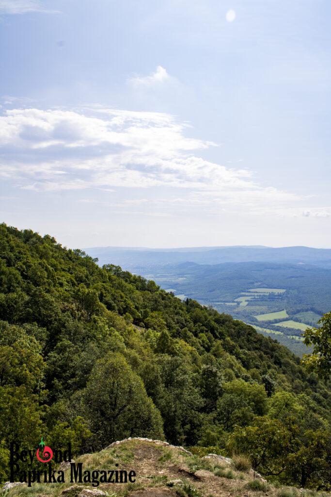

Viewpoints: Fekete-kő and Pilis Clearing
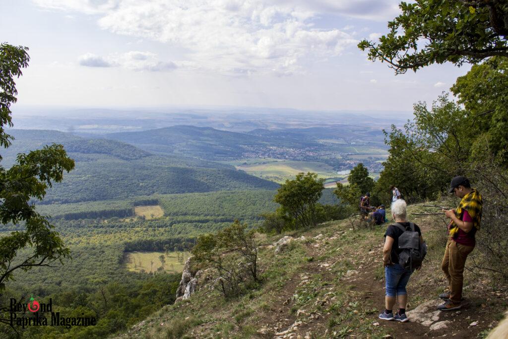
After Fekete-kő, return to the green cross, then switch to the green stripe trail. It follows the contour for quite a while, which makes for an easy, pleasant walk.
Don’t miss the detour to Pilis Clearing – the sign will show you. From this grassy, rocky outcrop you get a wonderful panorama to the west. It’s worth sitting down here for a while, just to take in the forest and surrounding hills.
Boldog Özséb Lookout
After the clearing, the last big climb begins. The green triangle leads you up to the summit of Pilis-tető. On the plateau you’ll find the bunker ruins, picnic tables, and the lookout tower.
Inside the tower, information boards tell the story of the hermits who once lived in the Pilis, and of Blessed Özséb, who founded the only monastic order of Hungarian origin: the Pauline Fathers. The Pilis was largely their territory in medieval times, and their history is closely tied to that of Hungary itself.
The view from the tower is breathtaking. To the southeast you see northern Budapest and the Megyeri Bridge. The oddly shaped peaks of the Pilis, the Danube Bend, and the Börzsöny Mountains all unfold before you. Further afield, the yellow scar of a quarry on Mount Naszály stands out, while in the opposite direction your gaze can wander across the Danube to Slovakia’s hills.
Ruins of the Air Defense Base
Once you’ve taken in the view, explore the bunkers – but carefully, as some are high and missing railings.
The way back follows the green triangle on a broad path, partly paved, partly rocky. A yellow bike route runs along the same road. Eventually you leave the military zone behind, pass through a gate-like structure, and re-enter the forest. The path leads between the Kis- and Nagy-Szoplak hills, before descending back to Kétbükkfa-nyereg, where the hike began.
Summary
This hike is full of panoramic views yet surprisingly manageable: only 11.2 km with 393 meters of elevation gain. It takes about 3.5 hours if you keep moving, but allow 5 hours to enjoy the scenery and take breaks.
I hope this description inspires you to visit the Pilis-tető. If you do, I’d love to hear your impressions in the comments – and feel free to share some photos from your own hike!
1 Comment
Hi, this is a comment.
To get started with moderating, editing, and deleting comments, please visit the Comments screen in the dashboard.
Commenter avatars come from Gravatar.